![]()
Water Resources Hackathon PROMPT
This year’s hackathon is focused on addressing the multi-faceted, highly critical and challenging topic of Water Resources. Here you will find a description of what you need to accomplish over the next 24 hours. We have identified five focus areas, described below, that are particularly important and have potential for innovative data-driven solutions. Teams can define projects in any of these areas, or at the intersection of one or more areas.
Hackathon Video Mentoring Space
The Wilkes Center's 24-hour climate solutions hackathon is a free event where students from the University of Utah and Université Côte d'Azur, France, have come together to brainstorm creative solutions for water resources in the face of climate change. Below, research professionals from both universities share short bits of expertise and guidance for finding specific water resource solutions.
Videos Posted Below
Changing Precip Patterns Impact Hydrology
Sara Warix
Assistant Professor,
Geology & Geophysics
University of Utah
My name is Sara Warix. I'm an assistant professor assistant professor in the Geology & Geophysics Department at the University of Utah.
I'm a hydrologist, so I think a lot about how climate change is impacting water quality and quantity. So, I think about how changes in precipitation patterns, things like increasing temperatures, more snow, changes in the timing of snow or impacting groundwater recharge, groundwater storage, transport and ultimately impacting the water quality and quantity in streams in mountainous areas.
I think one big one is thinking about municipal water supply. So, particularly in the western United States and other arid and semi-arid areas throughout the world, we're seeing changes in snowpack, so changes in precipitation, so changes in the magnitude.
Typically, we're seeing decreases during certain years of the timing. So as temperatures warm, melting snow is melting at different times and then changes and phase or typically seeing more precipitation falling as rain rather than snow and all combined, that's decreasing the amount of water that's entering these systems. So, we're seeing decreases in water available for municipal water supply.
So, any strategies that might focus on either reusing or reducing municipal water use would be advantageous in these locations where we're seeing changes in precipitation.
I think policy approaches that might encourage either individuals or industry to have to reuse water creatively or reduce water being able to use water, clean water for one task and dirty water for a second task so that we're reducing our overall consumption would be advantageous.
So as far as resources, I would recommend checking out the USGS, the United States Geological Survey. They have an NWIS Mapper, so it's N-W-I-S. And that has lots of long-term streamflow and water chemistry data that can give you a sense of where things are changing.
I think that we are living in a time where there's so many people focusing on water and changes in precipitation, changes in streamflow are really apparent.
So, I encourage you all to come up with any creative strategies to conserve and protect this precious resource.
The New Water Paradigm
Paul Brooks - Part 1
Professor, Geology & Geophysics
University of Utah
“I’m Paul Brooks in the Department of Geology and Geophysics here at the University of Utah.
A few points. One of the biggest points to keep in mind is that we've done a tremendous job over the last century within our memory and the memory of our family and parents and grandparents. Managing and supplying water to most people in the globe.
Granted, over the last two decades, there's been a rapid expansion in poor areas. But we've come to take water largely for granted. We've done a pretty good job. The changing of conditions, and granted, we've done a good job. It was slow to reach a lot of folks. There are still many people in the world who that hasn't.
And that promise or that availability of clean water hasn't reached yet. But we've made pretty good progress in expanding water availability. Certainly, everyone in Western society takes water for granted. You can go to the sink any time. You don’t worry about having food in the grocery store because the farmers have plenty of water for that. You don't worry about your ChatGPT query because the data centers have plenty of water for that.
You don't worry about whether or not you're going to be able to ski, because we know that we'll be able to make snow and have enough coverage. We’ve largely solved many of the issues of the past climate in terms of water supply, in a changing climate. Those boundary conditions aren't the same anymore. So, coming to take water for granted, which we largely have in Western society, has led to a situation where we rely on many shortcuts that we've developed under environmental conditions that are not what we have today.
And what we're likely to have moving forward in the future. What that requires is not solutions based on an individual discipline, whether it is crop water availability or whether it is water for municipalities, whether it is water for ecosystems and the environment. We have come to a point where our physical, legal, our modeling, and our knowledge infrastructure are at a tipping point. They’re broken.”
Take a Systems Approach
Paul Brooks - Part 2
Professor, Geology & Geophysics
University of Utah
“That leads to the second point to keep in mind as we re-envision what the legal infrastructure, the physical infrastructure. And by that, I mean conveyance or where we obtain water from rivers or groundwater.
Atmospheric water capture, recycling water, re-potable water. All the potential engineering and legal solutions that are on the table. We need to I strongly feel we need to stop doing them in isolation because water is not a static entity. Once you're done with it, it goes someplace else. It may go back to the sky. It may go into the ground.
It may go to a treatment plant. It may go to the Great Salt Lake. It may go to the next user downstream. Water is what we call an open cycle. It is intimately related to energy at every step of the way. Every step of the cycling of water is intimately and closely related to energy availability, whether it's solar energy availability, food, energy, and growing crops or, energy required in treatment or pumping.
The classical terms of energy that we think of in terms of electricity or fossil fuels. Solar energy. Geothermal energy. Water crosses all those boundaries, both conceptually, and it crosses those boundaries quite literally.
So, thinking of a solution to a water problem in isolation is one of the things that has gotten us to the point where we are now. The rules of thumb that we've developed now, whether it is for how big a dam should be or, how we should build bridges over dry washes or rivers or, how much water a crop will need to grow or flourish, or how we make sure forests don't die because they don't have enough water, because they haven't been managed well in the past.
All of those issues have been looked at in isolation, and the solutions have come up in isolation, but they're not in isolation. What happens to the snow that falls in the mountains? It feeds the rivers. It feeds the streams. It feeds the trees that live up there.
It recharges our groundwater on thousands of year time scale. It supplies the stream on weeks to several years, maybe a decade time scale. All of these uses and fluxes and water issues and problems are intimately connected. And where the biggest bang for the buck, in my opinion, is seeing where these issues and challenges are connected that we haven't thought about before.
And so that's why I think any issue with water is requires a system to approach. And thinking about a system where you're not just solving one problem. Each problem has a precursor constraints to it. And it also has downstream unintended impacts.”
Place-based Solutions
Paul Brooks - Part 3
Professor, Geology & Geophysics
University of Utah
“If you're focused on a place you can bring all the people that work in that place together. Because the people that work and live in that place have some sort of connection to it. And if it's very academic, you can generate a lot of new knowledge.
The first approach that I said, think about ways should be how you may move forward. But if you really want to move the needle, you need to include everyone that's going to be involved in the decisions. And so that means the public. That means everyone who votes, or has a loud voice, or a Twitter account, or Instagram, or posts TikToks on things that they care about. Or, simply just has a vested interest in having clean water and a clean environment.
A clean water and a clean environment are the same things. You might think about the air quality issues in the Great Salt Lake. The air quality issues of the Great Salt Lake are dust issues that have huge health impacts. I would say that's a water issue because we don't have water for the Great Salt Lake. So, thinking of these issues as place-based brings lots of people together who have a vested interest in doing better than we have in the past.
Thinking about that idea of place-based research, the Great Salt Lake watershed is a wonderful place to do that. One of the reasons I came here is because the Great Salt Lake watershed, the mountains next to the Great Salt Lake that feed water to the Great Salt Lake, has every issue that semi-arid regions around the world have in terms of water supply from adjacent mountains. But it's largely… primarily, it's in the state of Utah.
You know, there's a little bit in Idaho, a little bit in Wyoming, but we're all part of one watershed, one community, one government, one state. We're not dealing with upper basin and lower basin like the Colorado River. And then the sovereign nations of the Native Americans who have been short changed, and then Mexico. The solutions there, there's so many political hurdles there to solutions. It's very challenging.
A place like the Great Salt Lake watershed. Tremendous hurdles, all the same hurdles and issues where there's agriculture, industry, municipal water quality, air quality, drying of the Great Salt Lake, forests, recreation, all of those sorts of issues that occur in the Colorado River basin and semi-arid regions around the world occur here as well.
But it's easier to bring folks to the table. It's not easy, but it's easier. And so, any solution that is place-based helps you identify who needs to be part of the discussion, and helps you understand what they might bring to a solution.
The best technological solution in the world doesn't work if there's a policy hurdle. The best policy or legal solution in the world doesn't work if it's not technologically feasible.”
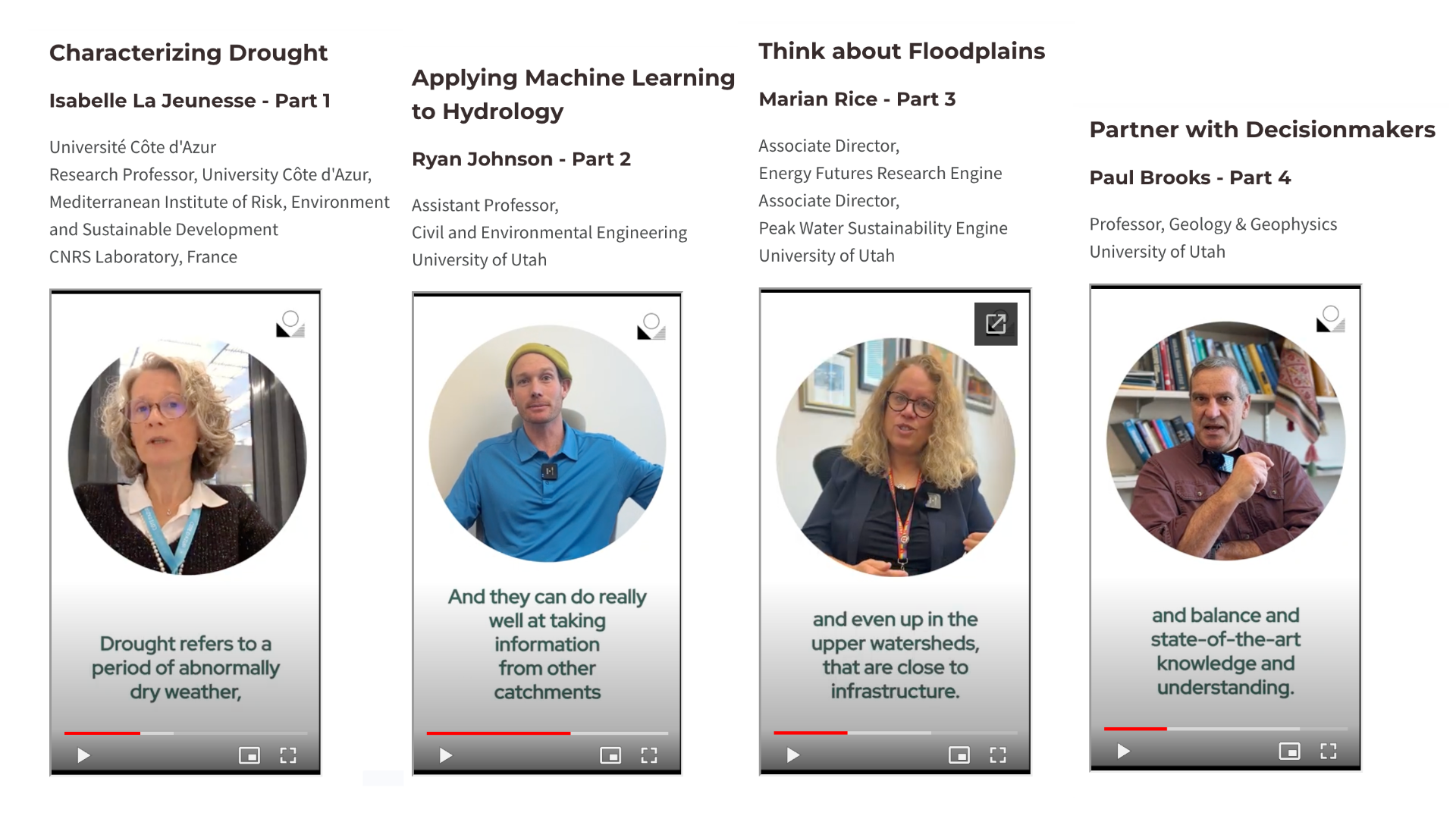
Partner with Decisionmakers
Paul Brooks - Part 4
Professor, Geology & Geophysics
University of Utah
“My first thought is that it doesn't need to be just a bunch of experts in the room, because the experts don't make the decisions. The experts can provide guidance and balance and state-of-the-art knowledge and understanding. And as an academic community, that's what we want to do. But we have to partner in a meaningful way with the people that actually make decisions.
I've seen many, many wonderful ideas for cutting edge research, just languish. And the academic community, the research community loves it. But it wasn't developed in a framework where someone who actually can make the decisions, is charged with making the decisions, could use that information. So, a partnership with people that actually make decisions, is probably the biggest thing to move forward.”
Water Markets Create Flexibility
Paul Brooks - Part 5
Professor, Geology & Geophysics
University of Utah
“One particular area that I think could be incredibly fruitful, would be tackling what is needed, in the western U.S., where our water is prior appropriation. We live under the rules of prior appropriation means the first people to put water to a beneficial use have the right to that water in perpetuity.
The state of Utah, just in the last couple of years, has made it possible for people, for the development of water banking, water leasing, water markets, which is a way for people not to lose their water rights but allow them to function on a market where, during a very, very dry year, someone who has an annual crop, might lease some of their water to a city who's afraid to have run out of water for their taps. Or they might lease their water to an agricultural entity where most of most of the rights are with agriculture, they might lease it to someone who grows perennial crops, that grows trees, pistachios, or almonds, or pecans, where if they run out of water, their entire crop goes back to zero.
They've had decades in growing these trees. And so, for them, the water is more valuable. It gives an opportunity for environmental groups, and for the state itself, if it chooses to, to see higher beneficial uses of water for things, getting more water to the Great Salt Lake as an example. So, thinking about what it would take to develop water banking, water market, water leasing framework.
Almost a mock… not a mock court, but a mock water market. What would you need there? Who would you need at the table? What expertise would you need at the table to allow water to follow a beneficial use? The best beneficial use, or a flexible beneficial use? I won't say best. Everyone will have a different idea of what the best use is. But have more flexibility in how water is used without completely decimating any one's rights to water in the future.
And so that would be just a fantastic way to move forward. The state has started to make that possible. There have been small watersheds around the West who have played with this a little bit, and it shows great promise for doing things like keeping water in the river or getting water to the Great Salt Lake while not totally decimating agricultural communities or cutting off, curtailing the potential growth and expansion of a knowledge economy that we have in urban areas.
It's a way to move simultaneously as we learn more about water, as we learn more about policy and law and priorities and the impacts that a changing climate has, it puts flexibility into the system. And so, I would love to see that built on. And it's going to require everyone. From me studying what happens to snowmelt, to plant ecologists studying how to develop a new crop, a more water efficient crop, and everybody in between.”
Forest Management Matters for Water
Paul Brooks - Part 6
Professor, Geology & Geophysics
University of Utah
“Another example would be how do we deal with forests? Our water all originates in the mountains. Most of those mountains are forest covered. It's incredibly expensive to thin forests. And we know unequivocally the way we thin fires is not the best for the forest.
And it's not the best for climate or water supply. It is based on methods that were developed 50 years ago. We know much more about what forest structure should look like now to mimic how it looked in the past, both to reduce threats of drought, beetles, fire, and create a more reliable water supply. So, that particular issue, how would you bring folks together to fund something like that?
There are some groups who have tried it in California. There are other folks who have worked on it in, in different locations. There's not a lumber market for much of the lumber. Some of that there is. But even if there was, they're not the mills to process it.
So, thinking about what the sources for the biomass are and what are the sources of funding, if you really could say sequester more carbon. Because carbon sequestration is a function of water. If you really could prevent fire.
If you envision how to bring in insurance companies and environmental groups to work with people that live in these areas and water supply agencies to help with our backlog of forest management or mismanagement issues.”
Characterizing Drought
Isabelle La Jeunesse - Part 1
Université Côte d'Azur
Research Professor, University Côte d'Azur,
Mediterranean Institute of Risk, Environment and Sustainable Development
CNRS Laboratory, France
“I'm Isabelle La Jeunesse, Research Professor at the University Côte d'Azur in the Mediterranean Institute of Risk, Environment and Sustainable Development. And in the laboratory, CNRS in France. I'm currently the coordinator of the Partnership Chair on Water in the French-Maritime Alps.
Today I would like to talk to you about drought characterization as it is important to understand what's happening to water resources in the context of climate change.
If you want to plan an adaptation strategy, and if you want to find effective adaptation measures for your region.
To start with, what is useful is to clarify what drought is compared to aridity and water scarcity. Drought refers to a period of abnormally dry weather, long enough to cause serious hydrological imbalance. This is in fact the definition of the IPCC. The Intergovernmental Panel on Climate Change.
Simply put, it means that drought is a temporary water shortage compared to the average situation. This means that to quantify what you think is a drought, you need to assess what is your average situation and if you have had water shortages or not.
Considering drought definition, any region of the globe can suffer from drought. And depending on the main causes or impacts, some definitions of drought have been proposed, which are usually grouped into six types.
And this is important to qualify it. You have meteorological drought, which is mainly due to a long period of no or very low rainfall. Then second, you have hydrological drought, which is characterized by below average river flows.
You can also have agricultural drought. This means that the soil moisture deficit is affecting your crops. You can also have mega drought, which is a persistent and extended, meaning spatial extension drought, that lasts for much longer period than normal. The normal in hydrology and metrology, which is assessed on a minimum of 30 years.
You can also have socioeconomic drought which, also to be considered drought, is induced by human factors, causing, for instance, excessive demands on the supply demand system that occur when the demand for water exceed the supply or exceed the renewable capacity of water resource. This is also what we call water scarcity.
Then there is a new category named flash drought, which is still not fully described scientifically, which is a rapid and short duration drought due to very intense heat and which each time damages agriculture.”
Water Governance Policy Options
Isabelle La Jeunesse - Part 2
Université Côte d'Azur
Research Professor, University Côte d'Azur,
Mediterranean Institute of Risk, Environment and Sustainable Development
CNRS Laboratory, France
“I’m going to share with you reference to a study on drought governance to see does the governance of water can explain water crisis and drought crisis regarding public policies we have in Europe seven policy options that are usually mentioned to adapt to drought and link to water governance.
Putting the right price tag on water.
Allocating water and water-related funding more efficiently
Improving drought risk management
Considering additional water supply infrastructures.
Fostering water efficient technology and practices.
Fostering the emergence of a water saving culture
And improving knowledge and data collection in order to anticipate drought risks.
Do these measures seem relevant to your region? Which could be the most appropriate?
Good luck in this hackathon!”
Partnerships Are Essential
Marian Rice - Part 1
Associate Director,
Energy Futures Research Engine
Associate Director,
Peak Water Sustainability Engine
University of Utah
“My name is Marian Rice. I'm in the Office of the Vice President of Research. I am the associate director of Energy Futures Research Engine. Associate director of PEAK Water Sustainability Engine. I lead the Critical Minerals Working Group. And also, on the Southwest Sustainability Innovation Engine leadership team.
I think there are a lot of opportunities, to help protect our watershed. For public engagement, it’s helping people recognize where does your water come from? I think it's a great opportunity. So, people recognize, hey, we actually do get our water where I'm hiking right now. And so, they're better at maybe being good stewards of the watershed.
I think policies and laws are what we have in place right now. And just keeping those and making sure we're just, being fair, hearing to those policies and laws of protecting that in terms of land use and others.
Another great approach, and Salt Lake City does this and other places do this as well is, purchasing land from willing sellers, to be in the public interest. So, keep that for our drinking water source, water protection. So, there's somebody wanting to sell the land, let's purchase that land and keep that for our source.
Water protection is a great approach to doing that. Partnering with our many other partners and stakeholders like the Forest Service, the state, nonprofits, its landowners such as ski resorts and others, to provide education, but maybe there's some opportunities from restoration. Again, one of the strategies we noticed in the upper watershed is also, acid mine drainage, although we don't see it in the drinking water supply when it gets to the plant.
We do recognize it's a stressor in the watershed. So, there are opportunities to partner, such as maybe a fan or an artificial fan or other ways to mitigate some of these, issues up there.”
Opportunities for Green Infrastructure
Marian Rice - Part 2
Associate Director,
Energy Futures Research Engine
Associate Director,
Peak Water Sustainability Engine
University of Utah
“Green infrastructure I think is really exciting. It has so many benefits, not only with this, water quality side for stormwater runoff, mitigating flooding as we have more green space to serve as that sponge. I think especially in urban areas and a lot of areas we're seeing these more intense precip events as a result of climate change.
So, when we think of flooding, obviously we think of runoff. But a lot of issues come in regard to intense precip events. So, I think was it 2017, we saw some intense precip events in Salt Lake City and a lot of flooding as a result of that. So green infrastructure is a great opportunity to help mitigate that water quality.
Also, getting your vegetation instead of asphalt and others. So, it can serve as well as kind of a climate carbon sink. It also provides esthetics and beautification and just better for community well-being. I think green infrastructure is a great opportunity as we start to see more and more development. And when you're developing, compared to existing infrastructure like Salt Lake City is pretty built out.
But some of these new areas such as like Farmington, other areas that are starting to build out from farmland, that's the opportunity to incorporate green infrastructure, incorporate maybe even some more public transportation and others, so you don't have as many cars on the road. And again, some more education too as well while you're doing that. So, incorporating it now is just really important as you start moving from agriculture to more urban areas.”
Think about Floodplains
Marian Rice - Part 3
Associate Director,
Energy Futures Research Engine
Associate Director,
Peak Water Sustainability Engine
University of Utah
“I think one thing that's critical there, when we start thinking about the big runoff events, which we had and what was it, 2023, and 2012, 2011, some great opportunities there is.
We have our creeks, especially near urban areas and even up in the upper watersheds, that are close to infrastructure. Again, let's start looking at ways that we can incorporate, the floodplain, connecting those water bodies to the floodplain. There's a lot of great examples in Salt Lake County where projects such as Murray, Taylorsville, Salt Lake City have done that.
They connect the creeks to the floodplain where maybe there's been sloughing so it helps protect those water bodies. There are water quality benefits, and when there's flooding there's a place for the water to go. So really incorporating a bigger floodplain area, having bigger offsets. Jordan River Commission is really advocating for that too as you see more and more development.
Let's put things back. Let's have some great, maybe some parks and others. But when it does flood, it has a place for the water to go to mitigate that. I know Salt Lake County does a lot of great work as well. They are the flood control authority per Title 17 plus state and county. So, they do a lot with flood control mitigation projects for runoff.”
Advance Water Treatment Strategies
Marian Rice - Part 4
Associate Director,
Energy Futures Research Engine
Associate Director,
Peak Water Sustainability Engine
University of Utah
“Some things they're doing as they rebuild these treatment plants is looking at innovative engineering and technology.
Obviously, we have concern with wildfire and again intense precip events. And when that happens you can't treat the drinking water if it's too high of turbidity. So, with that I'll say City Creek for example, they’re rebuilding that now. They incorporated some infrastructure elements to that should there be intense precip events and you cannot treat the drinking water due to turbidity.
Some settling basins and others and infiltration basins. And there's other advanced drinking water treatment such as, maybe UV, ozone, others, membranes. So, they're looking at those as well, recognizing due to emerging contaminants, climate change and others needing that advanced technology as well. I think one thing to recognize though, when you do that, is there's an increased cost.
There are increased capital costs because, again, it's very costly to install. There's an increased operation and maintenance costs with that. For example, in the energy water nexus, as your water quality starts to degrade in your source waters, you need advanced treatment. And that costs more money because of increased energy needs, increased chemicals, and others. So, there is an increased cost.
So then when you look at that, you also want to look at the affordability and financial impacts to residents and ratepayers across the board. How do you do that in an very innovative approach, so water is still affordable to everybody, but still able to maintain your drinking water infrastructure as well.”
Multi-Barrier Approach
Marian Rice - Part 5
Associate Director,
Energy Futures Research Engine
Associate Director,
Peak Water Sustainability Engine
University of Utah
“I highly recommend looking up the EPA multi barrier approach. They look at this because again it's more affordable. Preventing the pollution from actually getting into the drinking water source is the best approach. It's more affordable and it's better for community well-being and public health. So, using that multi barrier approach, finding a good source water. Again, we have City Creek Canyon Parleys, Big Cottonwood, Little Cottonwood, and others.
And protecting that source is just really critical. By doing so you're going to not require that advanced treatment. And in turn you would use less energy. Also looking at gravity fed. So we in Salt Lake City, for example, we get 60% of our drinking water from these upper watersheds. Those essentially count as our reservoirs.
That's snowpack, which is why climate change impacting that is such a big issue for the city and elsewhere throughout the whole nation, actually a global impact as well. Because with that now the timing is impacted. Runoff happens earlier, it happens faster. But demand is also increased in terms of time. So now people are starting to use their irrigation early in the year and longer as well.
But we don't have that snowpack. So, to supplement this as well, the city and other places use groundwater in the summer. Protecting that source as well, because I think everybody's heard of PFAS, “forever chemicals.” And should you start getting contamination in these groundwater sources, that's going to require a lot of treatment.
And that requires a lot of energy. And if you're having to use more groundwater sources, that pumping requires extensive energy. And I know there's been a lot of research that’s looked at that. The difference of a gravity-fed system from our source of water is the energy needs is just minimal compared to if you're getting your water from groundwater. Significantly more energy.
So again, protecting those upper watersheds, using that where itis gravity fed, requires minimal treatment because, again, the water is protected is definitely the most beneficial approach. And then should you need to go to groundwater, can you use it more strategically where you're using wells and others that, are better producers and have higher water quality.”
Recommended Resources
Marian Rice - Part 6
Associate Director,
Energy Futures Research Engine
Associate Director,
Peak Water Sustainability Engine
University of Utah
Cited Resources:
https://deq.utah.gov/division-drinking-water
https://www.saltlakecounty.gov/health/water-quality/drinking-water/
https://stormwatercoalition.org/
https://www.slc.gov/utilities/watershed/
“I would definitely recommend AWWA American Waterworks Association. They have a lot of amazing studies. They also have a policy arm and others, and they talk a lot about that.
They also have a local chapter, Intermountain Chapter as well. And they're just absolutely fantastic. American Water Resources Association, they are definitely focused more on the upper watersheds and others. So maybe it's more of a Clean Water Act side. Also I would say DEQ, especially if you're looking at drinking water, Division of Drinking Water, as well as Division of Water Quality. Division of Drinking Water is Safe Drinking Water Act. Division of Water Quality Services, Clean Water Act.
County health departments are fantastic. Salt Lake County Health Department, they have a drinking water section as well. And they do a lot in terms of drinking water protection, and regulations, and others. Also, public water systems are absolutely fantastic to talk to. For stormwater there's the Stormwater Coalition, if you're interested in learning more about opportunities to protect our urban water bodies.
Definitely the Stormwater Coalition. Obviously, Salt Lake County Watershed Planning Restoration Program, that also leads the Stormwater Coalition to be great looking at restoration along our especially our urban water bodies. But also do a lot of planning and others. I would say Salt Lake City Public utilities, they have a watershed program. They're absolutely fantastic.
And they're working on the watershed manager plan now, which includes a wildfire mitigation plan. Because again, recognizing should wildfires happen in these watersheds where we get our drinking water, it's impacting half a million people in the valley.
We always think of the infrastructure up there, which is also important, but also recognizing the importance of this upper watersheds should they be impacted by wildfire. Also, UACD Utah Conservation District, they are great in terms of agriculture and others as well as the Utah Department of Agriculture if you're interested in agriculture as well.”
Communicating Flash Flood Warnings
John Horel - Part 1
Professor,
Atmospheric Sciences
University of Utah
“I'm John Horel, professor in the Department of Atmospheric Sciences at the University of Utah. I'm involved in research related to mountain meteorology from worrying about, flooding and evaporation as well as wildfires and just being able to observe the atmosphere.
One of the unique aspects of our flash flooding is the time of year. You know, Utah is not unique, but we have a lot of impermeable soils, so sandstone. And so, in the summertime, when heavy precipitation falls, it can lead to rapid runoff and, expose people to a lot of risk.
The National Weather Service around the country issues flash flood watches and warnings. Warnings are when the flash flood is either underway or very imminent. And then watches are giving people a heads up, say 12 to 24 to 36 hours in advance. And so, it's relatively well established as far as being able to monitor the conditions from radar and other things for a warning.
Once it's underway, how do you alert people in advance? You know, with that lead time? Say, if you want to go recreating in the afternoon and the skies are clear and the information is available, are you aware of what the risk is going to be that afternoon? And so that kind of information is provided here in Utah by the Salt Lake City Weather Forecast Office as a flash flood potential ranking for high-risk areas like Zion National Park and all the other national parks in the state.
Local residents are typically aware of some of the risks associated with flash flooding in their area. And, you know, southern Utah is relatively sparsely populated. But there's over 10 million visitors annually to national parks and monuments in southern Utah and northern Arizona. And so those people are much less aware of the risks to flash flooding that can occur along major highways or when people start getting into the backcountry.
I think one of the areas that, is underutilized is getting the right kind of information out through social media. There's a lot of different kinds of use cases. So, you have different times of recreation groups, and they may be looking for information through specific apps and things that they're using. And they may be less aware of some of this information that's available from the National Weather Service.
So how do you take that information and blend it into the kind of applications that people have? And then also, how do you make that information available to people from international communities who may not even be aware of where that information could be? And they also may not be fluent in English in order to be able to understand what that information really means.
So, communicating that information more broadly is something that would be really useful.”
Monitor Evapotranspiration
John Horel - Part 2
Professor,
Atmospheric Sciences
University of Utah
“Once the water's available and is being used for agriculture, a lot is being lost through evapotranspiration. That is evaporation from water surfaces as well as the plants transpiring that. Agricultural areas lose a lot of water during pivot irrigation. So, ways to improve that and be able to monitor water loss from evapotranspiration is really critical.
Agribusiness is a big business. And using water wisely is really important. So, another aspect of it is especially, like in many arid environments, water loss from lake surfaces in reservoirs as well as from surrounding surfaces.
As areas experience drought we're potentially losing a lot of water from those resources. So, ways to be able to monitor that using remote sensing techniques and sensor systems becomes increasingly important.”
Forecasting Water Supply
Ryan Johnson - Part 1
Assistant Professor,
Civil and Environmental Engineering
University of Utah
Hi. My name is Ryan Johnson. I'm assistant professor in the civil environmental engineering department.
My specialty is water resources. And within water resources, applications of machine learning. And it's kind of focusing on the cryosphere and modeling our snowpack and then in predicting streamflow.
So, being located in the western United States, there's a strong need for water supply forecasting. We basically get most of our water in the western U.S. in the form of snow. And that's going to be in the wintertime. It accumulates from October until about April.
And then from there, April until there is no snow, it's going to be melting. And that goes to supply water to reservoirs for storage. If you think about the Upper Colorado River, there are several reservoirs there. Here in northern Utah, we have the Strawberry Reservoir. Here in Salt Lake City, Mountain Dell and Little Dell reservoirs. And that's all to store water from the wintertime and the snowmelt and then to supply water for the rest of the year.
So, water is going to be used to go to homes. So, let's say, for washing laundry, making food. And then a lot of it's going to go to irrigation. And so, the irrigation needs are important to have water supply to feed animals, feed ourselves. Understanding or quantifying how much water we have, or will have, is a very, very important.”
Applying Machine Learning to Hydrology
Ryan Johnson - Part 2
Assistant Professor,
Civil and Environmental Engineering
University of Utah
“So, AI and machine learning is kind of in its infancy within the hydrological sciences. Previously, a lot of has been physics-based. We're trying to understand some science questions. And those models are very good for that.
But there haven’t been significant advancements in the last 20 to 30 years with these physics-based models. For example, the river forecasting center just down the street is using a model created in the 1980s. And it works very well for a lot of its uses.
But still there hasn't been a lot of advancement in hydraulic sciences as far as operational forecasting in quite some time. Recently, especially with Google coming out, they have their own stream flow forecasting system based on machine learning, long short-term memory models, LSTMs. And they've showed a huge advancement in the model skill.
So, machine learning is taking off. And how can that be applied to train or “learn” these relationships between how much precipitation we have, how much snow we get, what are the different kind of catchment hydrology. So, what's the groundwater storage? What kind of vegetation? Evapotranspiration? Basically, all the land surface processes.
We're seeing that machine learning models can do quite well. And they can do really well at taking information from other catchments and applying it to conditions that maybe haven't been seen in catchments of interest. So, that's something that previously machine learning was shown to do poorly. But there's been some new methods developed with more data from around the nation, and world, that has been improving the skill of machine learning models.
An area that hasn't been explored a whole lot, at least to my knowledge, is using machine learning to quantify groundwater storage. So, that's a huge area of interest. And it's often a component of these hydrologic models that's neglected. Or they just assume that groundwater only goes down two meters, whereas, up here in the mountains we have huge groundwater storage.
We just don't know how much water it can hold. And machine learning, with different remote sensing products, satellite products, might be able to help quantify how much storage we have in groundwater.”
Good Hydrological Data Resources
Ryan Johnson - Part 3
Assistant Professor,
Civil and Environmental Engineering
University of Utah
“Let's see. First of all, for stream flow. The USGS, the United States Geological Service has an array of stream flow sensors. We have multiple sensors per stream out here, like around the Jordan River, Bear River, Weber. The three main tributaries to Great Salt Lake.
And you can access those through the National Water Information System. You can go to their website. If you Google any of these streams like Jordan River USGS gauge. And you'll get a number of gauges. It's an interactive mapping tool on their website to find out what those gauges are. You can click to see plots.
You can download the data manually. There's also a lot of tools through Python that you can programmatically go and access that data. And so, you can apply scripts, go and grab the data on its own. You can process it in the same script for all the sites and plot and compare. You can do historical trend analysis. However, you want with that.
The SNOWTEL network. It's a little bit more difficult to get that data. But the Natural Resource Conservation Service by the USDA, they have a great interactive map with all the locations, where those locations are. You can you click to download that data. There are multiple sites online that show you how to programmatically access that.
I encourage programmatically accessing the data. The National Snow and Ice Data Center. That's a key resource for any kind of cryosphere data product. Whether it's remote sensing. There's a lot of MODIS, satellite imagery that looks at land cover.
So, if there's snow covering an area of interest or not. You can get information on the fraction of snow-covered area. You can get the NASA Airborne Snow Observatory data. It’s lidar data sets of snow depth or snow water equivalent. And all the information on how to programmatically access that can be there.
There's also a SnowX, which is kind of a “hack week” in itself. And an outcome of this hack week was how you access and share all these data resources. There is another data resource that's very valuable for understanding drought and management of reservoir levels.
And here in the western US, upper Colorado region, the United States Bureau of Reclamation shares all of those data resources. You can go to their website, which we provide in the link, to see what the previous 40 days where. You can put date ranges and get long-term reservoir levels. And that'll allow you to connect.
Now we have streamflow, we have snow, and then we have reservoir levels. And see how those are all connected. And then there's a gap in there, which is groundwater. The USGS also has groundwater. They do water quality, groundwater depth. It's just not going to be as spatially continuous as hydrologists want to put into our hydrogeological models."
Reservoir Management and Forecasting
Ryan Johnson - Part 4
Assistant Professor,
Civil and Environmental Engineering
University of Utah
“So, a key tool has been developed by the Universe California San Diego, Scripps. And that's going to be the Forecast Informed Reservoir Operations, otherwise known as FIRO. And that's taken off and kickstarted in California because they have these large atmospheric rivers, and they dump a lot of precipitation in a very short period of time.
So, this concept of forecast, weather prediction, how much in the next seven days, ten days, how much rain are we going to get in a certain area? And then that can go into a hydrological model to produce how much water is going to go into a specific reservoir.
And then if we know how much reservoir is going to come in, we want to optimize our reservoirs. We want to make sure they're not going to be flowing over the reservoir. We don’t want the reservoir to be overtopping. It's uncontrolled water, essentially. That can cause downstream a lot of property damage, flooding downstream.
But we don't want to let out too much water ahead of the storm if we don't know how much water is going to come in. Because you might have to let out an entire year's water supply to make room for some incoming water. And then there's also other concerns like hydro electricity generation, recreation, and then ecological services.
So think recreation, people want to go fishing, windsurfing, like on the Columbia River. Recreational activity is high on those reservoirs. And then we have ecological components like here in Utah, we want to maintain a certain stream flow, cfs, cubic feet per second in the summertime to keep temperatures at a certain level for all the trout. Trout is a huge recreational activity out here.
So, we really want to make sure that we're maintaining our fisheries. Move back to the Columbia. We want to make sure that there's the right kind of conditions for salmon and steelhead to swim upstream. We want to try to improve spawning conditions. Then we also need to have storage for going to agriculture. So, it's really difficult to have all these beneficial uses. If we can be informed on how much water will be coming to that reservoir, we can better manage them for all these uses, drought, flooding, etc.”