The Wildfire Research Working Group is a cross disciplinary group of research faculty at the University of Utah exploring wildfire impacts, forecasting, and solutions.
Funded Wildfire Research Projects
University of Utah researchers are engaged in a number of projects to develop new technologies and policy mechanisms to advance resilience, prevention, and forecasting ability with wildfires. Explore this page to learn what current projects are happening.
Smoke and Wildfire Behavior
Forecasting
-
 The Alaska Fire and Fuels (AKFF) System was developed, upgraded, and operated by University of Utah researchers since 2014 to the present. This web-based system is used by the fire management community in Alaska to help wildland fire managers make decisions about readiness and response, tactical choices, public outreach and resource allocation.
Funded by the Bureau of Land Management Alaska
Funding period: 2023-2026
PI: John Horel -
 Wildland Fire Managers use assessment of current fuel conditions and expected weather to anticipate potential fire growth and to make decisions about suppression readiness and response, tactical choices, public outreach, and resource allocation. The state agencies responsible for fire management in Michigan, Minnesota, and Wisconsin began supporting in 2008 the development and operations of the Great Lakes Fire and Fuels System by software developers at the University of Utah.
PI: John Horel
Funder: Great Lakes Forest Fire Compact
Funding period: 2023-2026 -
The objective of this research project is to improve smoke pollutant exposure modeling for public health and understand the health impacts of smoke from fires upwind of Nevada.
PI: Matthew Strickland, Professor, Department Chair of Biostatistics, Epidemiology and Environmental Health, School of Public Health, University of Nevada, Reno
Co-Pi: Heather Holmes, Dept. of Chemical Engineering, University of Utah
Supporting Agency: NIH NIEHS R01 ES029528
Funding Period: April 1, 2019 to March 31, 2024Read the NIH award description.
-
Through the combined use of airborne and ground based mobile laser scanning, we are mapping wildland fire fuel structure with extreme precision, the results of which will be used to better understand the quantity and spatial distributions of fuels consumed in a fire. Pre- and post-fire airborne and mobile lidar have been collected on Monroe Mountain in central Utah, where prescribed crown fires offer unparalleled insight into the interactions between fuels, fire behavior, weather, and smoke.
Funder: USDA Forest Service
PI: Mickey Campbell
Co-PI: Phil Dennison
Funding Period: 2022-2024The Utah Remote Sensing Applications (URSA) Lab uses remote sensing data acquired from satellites, aircraft, and drones to explore applications solving real-world problems. They use data from a variety of different sensors, including hyperspectral, lidar, multispectral, and thermal infrared, to measure and map the Earth’s surface. They combine remote sensing with GIS to provide powerful tools to monitor changes in vegetation caused by drought and disturbance, assess wildland firefighter safety, and measure greenhouse gas plumes.
-
 Accurate wildfire and smoke modeling is extremely sensitive to the initial conditions: how dry are the fuels, where are the strongest winds, where is fire burning, and how high is the smoke being lofted? How and where these elements of the combustion triangle come together has a dramatic influence on the subsequent fire spread and smoke production. Current observational capabilities lack the coverage, resolution, and timeliness to produce the firefighter-scale forecasts that are needed to significantly improve wildfire management. However, improved observations alone will not lead to improved forecasts because there is a significant technological challenge in connecting observations with models.
This proposal will synthesize innovative observation capabilities, including mobile Doppler RADAR observations, the northern California Doppler wind LIDAR network, extremely high-resolution hyperspectral wind fields, and low latency satellite fire detections to develop the technology needed for utilizing these observations in coupled atmosphere-fire forecasting. The scope of this project is not necessarily limited to just these observations, but the technology developed here will be applicable to many other types of observational capabilities that are established through FireSense, integrating novels observations of fuels, the fire state, and the atmosphere.
Funder: NASA
PI: Kyle Hilburn, (Colorado State University)
Co-PI: Derek Malia (University of Utah, Dept. of Atmospheric Sciences)
Funding Period: 2023-2026 -
We propose to develop and verify a space-based distributed observing system to improve wildfire response decisions by monitoring and forecasting fuel flammability and wildfire spread and providing on-demand fire danger and burnt area maps. The system will use Global Navigation Satellite System Reflectometry (GNSS-R) within an intelligent, adaptive sensing framework, that leverages mid-TRL tools like D-SHIELD (Distributed Spacecraft with Heuristic Intelligence to Enable Logistical Decisions) and WRFx employing WRF-SFIRE (Weather Research and Forecasting Fire Spread Model). GNSS-R provides microwave data that can pierce through clouds/smoke/canopy, has a small form factor allowing for scalable constellations, and hence frequent data products during active fires than MODIS and VIIRS (12-24 hours). D-SHIELD is a software tool suite for optimal, ground-based, observation planning for a constellation of spaceborne instruments informed by dynamic scientific objectives (AIST-18). WRFx is an integrated fire and smoke decision support tool (AIST-21). Resultant data products will be used to enhance existing USGS fire danger products and the USGS-supported LANDFIRE fuel layers product.
Funder: NASA
PI: Sreeja Nag, (Ames Research Center)
Co-PI: Derek Malia (University of Utah, Dept. of Atmospheric Sciences)
Funding Period: 2023-2026
Health and Ecological
Impacts
-
 The University of Utah's Land-Atmosphere Interactions Research (LAIR) group is studying the role of wildfires from both the greenhouse gas and air quality perspectives. In projects funded by NOAA and DOE, the group is seeking to quantify and understand the impact of wildfires on the carbon budget, with a special focus on the American West. For this purpose, we combine biospheric and atmospheric models with extensive observational datasets, with an eye towards improving NOAA's CarbonTracker system and the Community Land Model (CLM), which has been supported extensively by DOE.
In regards to air quality, we are examining the contributions of wildfires towards the enhancement of pollutants such as CO, O3, and PM2.5 in urban areas. High concentrations of these pollutants can cause adverse health effects, particularly in those with lung and heart disease and vulnerable populations such as children and the elderly. With support from Utah's Department of Environmental Quality, we are seeking to quantify the role of wildfires on degrading air quality across population centers in northern Utah.
In order to address the aforementioned objectives, accurate atmospheric modeling of fire plumes is necessary. To assess the accuracy of our atmospheric models and to improve upon it, we are working with the U.S. Forest Service's Missoula Fire Laboratoryto analyze data from the RxCADRE experiment.
-
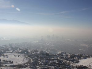 This field campaign is focused on gaining a better understanding of the mechanisms for atmospheric ozone formation throughout the Wasatch Front near Salt Lake City, Utah. During the summer of 2024, aircraft-based measurements of ozone and the precursors leading to its formation will be made in the atmosphere around Salt Lake City. This research is focused on improving the photochemical modeling that predicts the formation of high ozone concentrations. The results are expected to contribute to the development of mitigation strategies that can help reduce ozone pollution around Utah's Wasatch Front. Specifically, the project will diagnose how the addition of wildfire smoke changes the sensitivity of ozone production in the urban environment.
Funder: NSF
PI: Emily Fischer (Colorado State University)
Co-PIs: Ilana Pollack (Colorado State University), Lu Hu (University of Montana), Reem Hannun (NASA), Anna Gannet Hallar (University of Utah)
Funding Period: 2023 to 2026 -
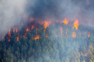
This project is studying the effect of chaotic wind patterns on wildfire propagation patterns. They use computational fluid dynamics techniques to study wildfire growth, and they use dynamical systems and chaos theory to understand the role of chaotic wind patterns in wildfires.
Funder: NSF Combustion & Fire Systems Program
PI: Amir Arzani, Departments of Scientific Computing and Imaging Institute and Mechanical Engineering, University of Utah
Co-PIs: Rob Stoll (Utah, ME), Fatemeh Afghah (Clemson), Ali Tohidi (San Jose State University)More information available here: https://bio.mech.utah.edu/
-
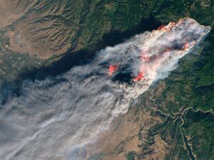 The goal of this research project is to use a cross-disciplinary approach to improve our fundamental understanding of wildfire smoke plume dynamics and complex atmospheric flows governing smoke transport over mountainous terrain.
PI: Heather Holmes, (Department of Chemical Engineering, University of Utah)
Funder: NSF CBET 2048423
Funding Period: July, 1, 2020 to June 30, 2025 -
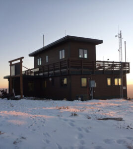 The Hallar Aerosol Research Team (HART) seeks to understand connections between between the atmosphere, biosphere, and climate, along with the impact of anthropogenic emissions on these connections. The group is made up of students and researchers from many different scientific backgrounds, including atmospheric science, chemistry, biology, mathematics, snow hydrology, and physics. The group publishes frequently in a variety of fields and disciplines including aerosol science, cloud microphysics, instrumentation, and atmospheric chemistry. Dr. Hallar is director of a mountain-top aerosol research facility called Storm Peak Laboratory, located in Steamboat Springs, Colorado, where team members are able to visit and work developing new instrumentation and field work skills.
 -
 Across the Western U.S., the number of large wildfires has been steadily increasing since the early 1980s leading to degraded air quality. Wildfire smoke is known to worsen cardiopulmonary and neurovascular outcomes, however its impact on surgical patients is unstudied. Surgical populations are especially vulnerable to wildfire smoke due to the surgical inflammatory response which can synergize with pollution related inflammation. We hypothesize that patients presenting for surgery during wildfire smoke events will experience worsened perioperative outcomes (e.g. stroke, MI) compared to clean air days.
PI: John Pearson, (School of Medicine, Anesthesiology, University of Utah Health)
Co-PI: Derek Malia (University of Utah, Dept. of Atmospheric Sciences)
Funder: 1U4U Innovation Funding
Funding Period: 2023-2024
Community Health and Response
Solutions
-
 Through $5M funding by the U.S. National Science Foundation (NSF) and $3.75M funding by the Natural Sciences and Engineering Research Council of Canada (NSERC), the University of Utah and University of Calgary will establish and co-lead the U.S.-Canada Center on Climate-Resilient Western Interconnected Grid.
The Western Interconnected Grid, commonly known as “the Western Interconnection,” is one of the two major interconnected power grids in North America, which stretches from the northern edge of British Columbia, Canada to the border of Baja, Mexico, and from the California coast to the Rockies, and serves roughly 80 million people over 1.8 million square miles across two Canadian provinces and fourteen western states in the United States. The Western Interconnection is the backbone of one of the largest regional economic engines in the world.
Masood Parvania, associate professor of Electrical and Computer Engineering at the University of Utah’s John and Marcia Price College of Engineering will co-lead the center along with Hamid Zareipour, professor of Electrical and Software Engineering at the University of Calgary’s Schulich School Engineering.
At the University of Utah, the center involves co-principal investigators Valerio Pascucci, professor at the Scientific Computing and Imaging Institute and Kahlert School of Computing, William Andregg, director of the Wilkes Center for Climate Science and Policy, and Divya Chandrasekhar, associate professor in the Department of City and Metropolitan Planning in the College of Architecture and Planning, among multiple other partners and faculty.
The U.S.-Canada Center on Climate-Resilient Western Interconnected Grid creates an interdisciplinary and international partnership that brings together leading experts in power engineering, climate, forestry, data, policy, and social sciences, as well as industry, entrepreneurs and community knowledge holders from a network of 35 partners across academia, industry, government, and communities with the mission of enhancing the power grid resilience to the rising frequency, intensity, and duration of extreme weather events, such as wildfires and heatwaves.
The academic members of the center include the University of Utah, University of California San Diego’s WIFIRE lab, University of New Mexico, and Desert Research Institute in the U.S., as well as University of Calgary, University of British Columbia, University of British Columbia Okanagan Campus, University of Alberta, University of Saskatchewan, University of Regina and Thompson Rivers University in Canada.
-
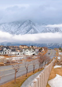
Objective of this project is to develop neighborhood-scale, actionable air-quality information for the state of Utah to help reduce exposure to air pollutant hazards from dust, smoke, and temperature inversions, particularly for children. This study is supported by NSF's Civic Innovation Challenge (CIVIC).
PI: Kerry Kelly, Department of Chemical Engineering, University of Utah
Other UU Faculty: Heather Holmes (Chemical Engineering), Sara Yeo (Communication), Ross Whitaker (Kahlert School of Computing), Derek Mallia (Atmospheric Sciences)
Supporting Agency: NSF RISE 2322009
Funding Period: Oct. 1, 2023 to Sept. 30, 2024NSF press release about this award, NSF award description, and the University of Utah press release.
-
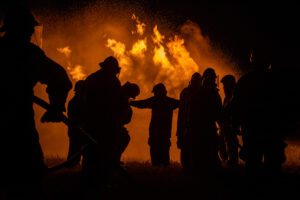
The Firefighter Estimated Ground Evacuation Time (GET) layer is among the most widely used spatial decision support tools in US fire management that provides a contiguous US-wide, high resolution representation of the amount of time it would take to evacuation to the nearest medical facility from anywhere on the landscape. URSA Lab has been contracted to update and improve this layer, the results of which will enable more accurate and informed safety-focused decision making on future wildfire incidents.
Supporting entity: US Forest Service
PI: Mickey Campbell
Co-PI: Phil Dennison
Funding Period: 2023-2024The Utah Remote Sensing Applications (URSA) Lab uses remote sensing data acquired from satellites, aircraft, and drones to explore applications solving real-world problems. They use data from a variety of different sensors, including hyperspectral, lidar, multispectral, and thermal infrared, to measure and map the Earth’s surface. They combine remote sensing with GIS to provide powerful tools to monitor changes in vegetation caused by drought and disturbance, assess wildland firefighter safety, and measure greenhouse gas plumes.
-
 Lookouts, communications, escape routes, and safety zones (LCES) are among the most important tools available to wildland firefighters to ensure their safety while battling an increasingly complex fire environment. Through the study of the spatial dimensions of LCES, we are seeking to better understand how geospatial modeling and remote sensing can be infused into fire safety operations to improve the consistency and reliability of LCES implementation.
Funding organization: NSF
PI: Mickey Campbell, Department of Geography, University of Utah
Co-PI: Phil Dennison, Department of Geography, University of Utah
Funding period: 2021-2024The Utah Remote Sensing Applications (URSA) Lab uses remote sensing data acquired from satellites, aircraft, and drones to explore applications solving real-world problems. They use data from a variety of different sensors, including hyperspectral, lidar, multispectral, and thermal infrared, to measure and map the Earth’s surface. They combine remote sensing with GIS to provide powerful tools to monitor changes in vegetation caused by drought and disturbance, assess wildland firefighter safety, and measure greenhouse gas plumes.
-
 This partnership with the USDA Forest Service is focused developing spatial datasets and open-access tools for the geospatial implementation of LCES. These include a Google Earth Engine-based mapping tool for evaluating the suitability of potential safety zones anywhere in the US, and an R package that enables users to map proportional visibility using airborne lidar and machine learning.
Funding organization: USDA Forest Service
PI: Phil Dennison, Department of Geography, University of Utah
Co-PI: Mickey Campbell, Department of Geography, University of Utah
Funding period: 2021-2024The Utah Remote Sensing Applications (URSA) Lab uses remote sensing data acquired from satellites, aircraft, and drones to explore applications solving real-world problems. They use data from a variety of different sensors, including hyperspectral, lidar, multispectral, and thermal infrared, to measure and map the Earth’s surface. They combine remote sensing with GIS to provide powerful tools to monitor changes in vegetation caused by drought and disturbance, assess wildland firefighter safety, and measure greenhouse gas plumes.
-
 Determining how fast firefighters can move through landscapes of various conditions is critical to understanding evacuation behavior. This grant is focused on improving our understanding of pedestrian travel rates through controlled experimentation and the analysis of crowdsourced GPS data.
Funding organization: USDA Forest Service
PI: Phil Dennison
Funding period: 2019-2024The Utah Remote Sensing Applications (URSA) Lab uses remote sensing data acquired from satellites, aircraft, and drones to explore applications solving real-world problems. They use data from a variety of different sensors, including hyperspectral, lidar, multispectral, and thermal infrared, to measure and map the Earth’s surface. They combine remote sensing with GIS to provide powerful tools to monitor changes in vegetation caused by drought and disturbance, assess wildland firefighter safety, and measure greenhouse gas plumes.
Tools & Datasets
-
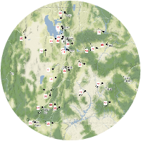 MesoWest Tool
MesoWest is a cooperative project started at the University of Utah in 1996, with a goal of providing access to current and archived weather observations across the United States through web-based resources.
-
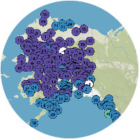 Alaska Fire and Fuels System Tool
Alaska Fire & Fuels is an interagency resource for fire weather and fuel conditions throughout Alaska. Prior, current, and future conditions are accessible.
This project is the result of a contract between the Alaska Fire Service and the University of Utah MesoWest and Synoptic Labs (MW/SL). Previously, MesoWest developers have developed fire management applications for nationwide application and a similar service for the Great Lakes Forest Fire Compact (GLFFC), serving the great lakes states and provinces. The goal is to use the data assets of MW/SL to increase the available information regarding wildland fire environments in the state of Alaska.
-
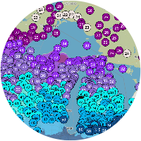 Great Lakes Fire and Fuels System Tool
Great Lakes Fire & Fuels is a meteorological hazard analysis resource for wildland fire managers in the Great Lakes states.This was developed by MesoWest at the University of Utah for the Great Lakes Fire and Fuels Compact.
-
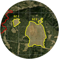 Firefighter Safe Separation Distance Evaluation Tool
This open-source Google Earth Engine tool allows users to evaluate the suitability of any potential wildland firefighter safety zone in the US. Users can draw in an area that could function as a potential safety zone, and the underlying algorithm examines surrounding terrain and fuel conditions, along with wind speeds and fire behavior to determine whether that safety zone would provide sufficient separation distance from surrounding flames to avoid burn injury.
-
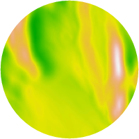 VisiMod: An R package for modeling landscape-scale visibility using airborne lidar and machine learning Dataset
This R library is designed to facilitate landscape-scale mapping of proportional visibility – how much of one’s surroundings can be seen from a given vantage point – using a combination of airborne lidar and machine learning. Given the importance of visibility in maintaining situational awareness, the aim is to enhance and improve wildland firefighter safety through broad-scale, user-friendly visibility mapping.
-
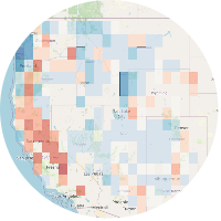 Carbon Futures Modeling Tool
This is interactive tool shows carbon storage potential in forests in the US.
These datasets project the end-of-century aboveground live carbon storage potential in contiguous US (CONUS) forests in two future climate scenarios. The researchers systematically compared and provided a multi-method synthesis of the 21st-century potential of carbon storage in CONUS forests and observed some forests at consistently high risk of loss of carbon permanence across three major state-of-the-science approaches.
-
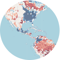 Global Forest Climate Risk Tool
This tool projects the relative risk to Earth’s forests globally during the 21st century based on multiple approaches, datasets, and climate change scenarios.
These datasets project the relative risk (percentile) to Earth’s forests globally during the 21st century based on climate change scenarios. These projections identify which parts of the worlds’ forests may be more vulnerable to future climate change within the framework of seven different data layers capturing three different modeling approaches.
-
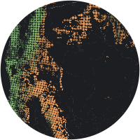 US Forest Risks Mapping Tool
This map tool shows harmonized projections of risks to US forest carbon from fire, drought, and insects under a changing climate.
The researchers analyzed the historical relationship between climate conditions and three key forest risks — fire, drought, and insects — by combining satellite and ecological data with climate and hydrologic variables representing water availability. They then used the resulting statistical models to produce spatial maps of projected risks of these disturbances through the end of the 21st century. They projected risks to forests based on three future climate scenarios.
-
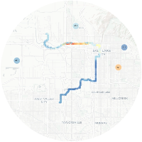 Utah Greenhouse Gas Monitoring Tool
This map provides real-time data on CO2 and methane emissions at strategic monitoring sites across northern and eastern Utah.
The Utah Atmospheric Trace Gas & Air Quality (UATAQ) lab was started in 2013 as a joint effort between the Global Change and Sustainability Center, the Department of Biology and the Department of Atmospheric Science. The mission of the lab is to collect and analyze long term, high frequency, high precision, and spatially variable trace gas and air quality data with the aim of understanding the spatial distribution and long term trends throughout Salt Lake Valley and Northern Utah. Building on the work of one of the founding members, Dr. Jim Ehleringer, the lab has been responsible for improving and expanding existing networks of instrumentation, developing and implementing new networks with different aims, and building an on campus facility for research, development, and student outreach. UATAQ specializes in the long term measurement of both mobile and in-situ trace gas and criteria pollutants. Our data is calibrated to international standards and we possess numerous years of experience in collecting trace gas data, including one of the longest continuous urban CO2 records in the nation.
-
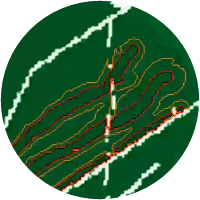 QES-Fire Tool
A Dynamically-Coupled Fast-Response Wildfire Model.
A microscale wildfire model (QES-Fire), which dynamically couples the fire front to microscale winds, was developed utilizing a simplified physics rate of spread (ROS) model, a kinematic plume-rise model and a mass-consistent diagnostic wind solver. The model is 3-D and includes coupling between fire heat fluxes and the wind field. QESFire's ability to represent the strength of convection (e.g., updraft velocity and buoyancy flux) is evaluated by comparing the velocity fields from QES-Fire to the resultant velocity fields from a convective atmospheric large eddy simulation using the Weather Research and Forecasting model (WRF). QES-Fire has less than a 7% relative difference in the centerline vertical velocity, and less than a 10% relative difference in the integrated buoyancy flux from those calculated by WRF at a speed 8800 times faster per computational core than WRF. Additionally, the model is compared to ROS and tower data from the FireFlux II field experiment, with less than a 10% relative difference in the ROS.
-
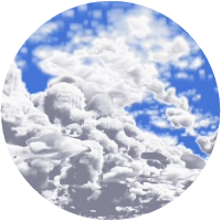 SAM-Fire Tool
The SAM-Fire Tool is an atmosphere-wildland fire model which couples the Balbi rate of spread model (Balbi et al. 2020) with SAM, a large-eddy simulation model. SAM is used by dozens cloud modelers in the United States and beyond. SAM currently exists in two major versions. The public version is available for other researchers. It is formulated on the original Cartesian grid, with constant horizontal and variable vertical spacing. (Contact Steve Krueger, steve.krueger@utah.edu)
Published Wildfire Studies
2024 Wildfire Hackathon Video Mentoring Space
U research faculty and local US Forest Service professionals share expertise and guidance on wildfire solutions.
